|
 |
 |
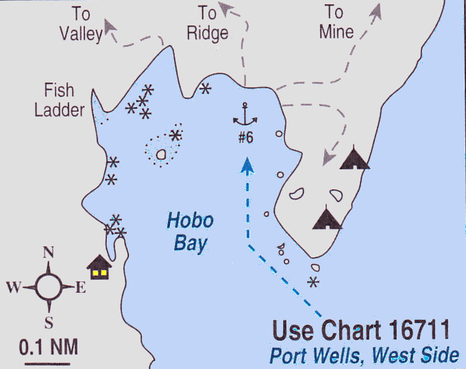
#6).. HOBO BAY:
The anchorage is very uncomfortable on rare S winds and even experiences some refracted swell during prevailing northerlies.
PILOTAGE:
Enter Hobo staying well off the N point. Head for the NE corner, staying about 100 yds. off the E (peninsula) shore in depths of about 30-40 feet. Anchor in about 30 ft. with a mud and shale bottom. We would not recommend navigating the middle of the bay. A cursory survey of the area revealed no water depths over 40 ft. and extensive shoal areas around the rock in the middle and off the cabins on the SW shore.
HIKING:
Several small lakes on the peninsula make good destinations for short, after-dinner walks.
HOBO VALLEY:
Starting from the beach just N of Hobo stream, follow a series of peatland bogs to the crest of the small ridge. The W side of the ridge is forested but easy to walk through and descends to a valley filled with peatland bogs.
RIDGE HIKE:
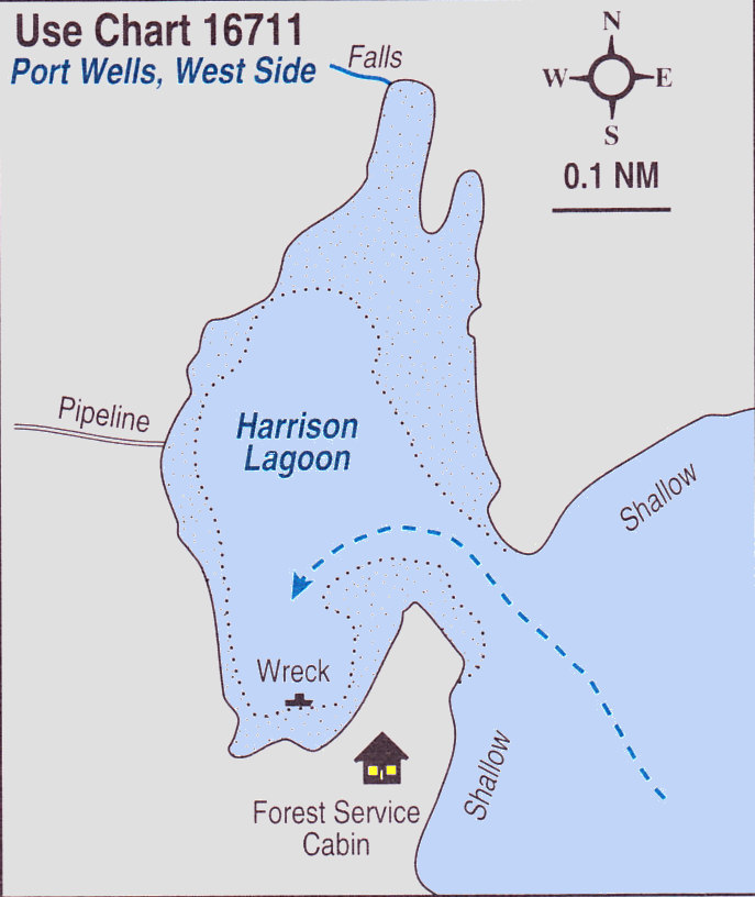
From the anchorage pick out a route ascending through the openings to the knoll on the ridge visible from the anchorage. Expect to weave through steep woods with lots of blueberry bushes that gradually peter out. The ridge is open hiking with good views of Port Wells, Harrison Lagoon and a valley with numerous waterfalls.
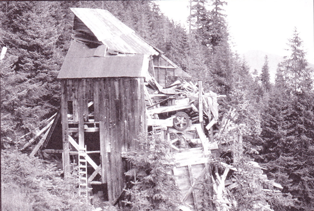
GRANITE MINE:
It is an easy 0.5-mile walk from Hobo Bay to the Granite Mine. The route winds across rolling terrain and through peatland bogs and meadows filled with purple shooting stars, showy columbines, fragrant bog candle orchids, and purple monks hood. Start from the NE shore of Hobo Bay and follow the openings heading N parallel to Port Wells. After passing a small lake where Canada geese often nest, you will reach a small tidal lagoon. from here, follow the opening up the hill still contouring north. After another dip and rise you will see a line of alders crossing the peatland bogs. The alders are growing on the old corduroy road to the mine. Instead of going downhill to the large tidal lagoon, follow the road to the stamp mill. It is a delight to see, here, an old truck with a wooden steering wheel looking serenly out over Port Wells. The road contours around a marshy area to reach the hillside behind the stamp mill. It is about a 0.5 miles walk up the switchbacking corduroy road to the first of a series of cabins, tailing piles and mins shafts. The mine is private property. The shafts are unmaintained and dangerous; the walk through the woods is excellent.
CAMPING:
The long beach outside the entrance is a popular camping area.
HISTORY:
M.L. Tatum and Johnathan Erving located the Granite Mine lode in 1912. Between 1913 and 1922, Granite Mine was a busy place. in 1915, a 10-stamp mill replaced the small on-site 7 ft. Lane Mill. As production continued to increase with over 2000 ft. of workings by 1915, the post office was moved from Golden to Granite to serve the 50 men working here. Most of the production occured from 1916 to 1922. Since 1930 the mine has had several owners and reported only minor production (1934 to 1937, 1940 to 1944 and 1963 to 1964). A hydroelectric plant was installed one mile N of he property in 1933. In 1985, the owners were planning some development work to discover if the mine was worth reopening. The Granite Mine was one of the most productive mines in the Sound reporting 24,940 ounces of gold and 2,492 of silver extracted from 31,919 tons of ore dug from more than 8,200 ft. of workings.
HISTORY:
HIKING:
CAMPING:
HARRISON REEF: