|
|
One of the most scenic regions in the Sound, Port Nellie Juan and Kings Bay abound in signs of recent glaciation. The termini of eight of the area's nine valley glaciers have only recently retreated onto land leaving Nellie Juan Glacier as the only remaining tidewater glacier. In many areas, the vegetation has not yet had a chance to re-establish itself. The actions of glaciers on a granite batholith have left Yosemite-like valleys containing imposing domes and sheer granite cliffs.
The water is deep and relatively hazard-free. A nasty chop and waves higher than normally encountered in western Prince William Sound can build in the mouth of Nellie Juan during strong easterly and southeasterly winds. Such winds commonly reach into the bay as far as Blue Fiord where they usually die out as they meet an opposing wind off Nellie Juan Glaicer. In settled weather the fiord is calm during the early part of the day. Toward late afternoon, a land breeze off Nellie Juan Glacier stretches as far as Mink Island before encountering a sea breeze from the mouth. Kings Bay is ordinarily quite calm. Port Nellie Juan and Kings Bay experience fewer strong westerlies than do the fiords to the north, and their anchorages afford better protection from westerlies.
LAND OWNERS:
CNF. ADF&G classifies all estuaries as curcial habitat.
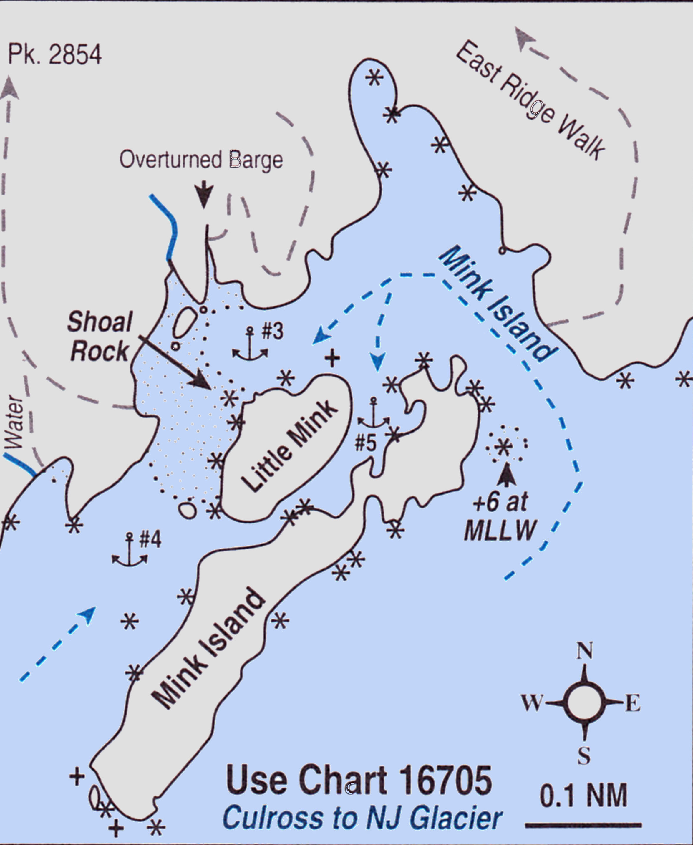
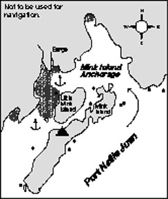
#3-5).. MINK ISLAND:
The NE entrance is deep. On entering, especially when approaching from the SW, take care to aviod the rock that only shows when the tide is 6 ft. or less. it is approximately 400 ft. E of Mink Island. favor the NE side of the channel.
#3).. ANCHOR:
In the West corner in 30-50 ft. about 0.15 NM E of the stream. There is a
sunken barge closer in to the major stream. Try to locate the "shoal" rock
that shows only at low tides off th NW point of Little Mink Island. This will
help you make sure you do not swing over the shoal. There is adequate swinging
room for a fair number of boats if some do not mind anchoring in deeper water.
#4).. SW ENTRANCE ANCHOR:
Go to the SW of the islands across a shallow patch. The shallows nearly dry on minus tides. Passage betweem these anchorages should not be atempted except at extreme high water and only after locating Shoal Rock. This anchorage is best approached from the SW where the channel is clear and deep in the middle. Anchor in 60 ft. at the head. The channel is open to southwesterly swell and winds off Nellie Juan Glacier but is reported to be quieter in easterly weather than the first anchorage.
#5).. PASSAGE:
Small, shallow-draft boats can anchor between Big Mink Island and the E side of Little Mink in 25 ft. with room for just under 4:1 scope. Rock ledges and shallow water limit the swinging room.
Hikes:
Effects of a tsunami accompanying the 1964 Earthquake can still be seen. The barge, Nellie Juan No.5, belonging to Port Nellie Juan Cannery, lies overturned about fifty yds. up in the woods in a tiny bight on the N shore. If you look carefully you can still find scars on trees along the bight from the tsunami and barge, but the amount of regrowth since 1964 now makes this a challenge.
EAST RIDGE:Begin from a small beach near the entrance. The first part is brushy woods with few openings. Stay on the ridge. Once timberline is reached, the ridge is open and easy walking with good views over Culross and Nellie Juan.
PEAK 2854:Begin near the creek for filling water jugs. Beach area is limited. It is a steep ascend through the brush and woods until finally the openings begin. On reaching the openings, contour to the right and up to the ridge. It is easy walking above timberline along the ridge to the summit.
WILDLIFE:
The wetlands at the mouth of Mink River abut an important pink salmon spawning area classified as crucial habitat by the ADF&G. Large fish trap anchors (reportedly removed) and cables around trees betoken former fisheries activities. Many of the salmon spawn in the intertidal zone. This is perhaps an adaptation salmon in Prince William Sound have made to living in an area that has experienced frequent up-life and subsidence. Literally thousands of salmon spawn and die here, becoming food for a rich assortment of marine invertebrates, birds and mammals. Black bears can often be observed resting in the salt marsh grasses, feeding in the stream, or disappearing with a salmon into the woods. In August and early September, the smell of rotting salmon is sometimes overwhelming.
SHORE BOAT TRIPS:
Cruising the shorelines around Mink and Little Mink islands bring a few suprises. On Little Mink island, one can still see a large, cut log lying high and dry perched across a gully where the 1964 tsunami deposited it. There are at least two eagles' nests in the area.
The storm-battered coastline between Mink and Culross Passage has colorful cliffs and some of the most interesting shoreline in Port Nellie Juan. Paddling S of Mink Bay leads to some grottoes and powerful waterfalls flowing out of a series of chain lakes.
CAMPING:
Campers sometimes camp on Big Mink Island. There are potential campsites along the banks of the Mink River; however, black bears frequenting this area have been known to challenge intruders and destroy kayaks.